This article is about ground survey in archaeological exploration, which is also referred to as ground reconnaissance in archaeology. The outline of this article will be as follows:
- Introduction to ground survey in archaeology
- Types of ground survey in archaeology
- Methods and techniques of ground survey in archaeology
- Importance of ground survey in archaeology
This will provide adequate answers to questions such as: What is the ground survey method in archaeology? What are the geophysical survey methods in archaeology?
Read the main article: Archaeological Exploration: Survey: or Reconnaissance
Introduction to Ground Survey in Archaeology
In archaeology, there is a process of study called the archaeological process. That means conducting studies in archaeology step by step. There, the first step is exploration. The terms, survey and reconnaissance also mean exploration. So, archaeological exploration, archaeological survey, or archaeological reconnaissance is the systematic method of searching for archaeological remains to identify and record archaeological sites and archaeological remains.
Archaeological exploration or reconnaissance consists of three main types of exploration: ground reconnaissance, underwater reconnaissance, and aerial reconnaissance.
Ground reconnaissance, or the ground survey in archaeology, is the type of archaeological exploration that we conduct in inland areas of the earth to recognise archaeological sites as well as archaeological records scientifically.
Simply put, ground surveying is one of the three types of exploration in archaeology, which is for conducting land-based surveys.
Types of Ground Survey in Archaeology
There are several ground survey types in archaeology. But, before we move into those, it is best if we recall our knowledge of typologies in the much broader topic of archaeological survey. That will help us understand the content in this article with ease and resolve any confusion you may have.
As you may be aware, what we call types come from typologies. Then, typologies are based on a theory, approach, or perspective. In simple words, how we divide something into types totally depends on how we see it. That means any set of items that includes more than two items can at least have two typologies, as we can see the same set of items in different ways.
Therefore, when you search for types of surveys in archaeology or types of ground surveys in archaeology, the results you get can be a bit confusing. Because the results may show you more than one typology, and sometimes the results may show you all the types mixed up together, combining two typologies. When you read those types, you may find that there seems to be no logic there. Hence, we need to understand that there can be several typologies in a single set of data. Then, we can understand the typologies, their approaches, and their types (items) without any confusion.
Types of Archaeological Survey
So, when it comes to archaeological explorations, we divide them into three types:
- ground reconnaissance
- underwater reconnaissance
- aerial reconnaissance.
The foundation for this division of archaeological exploration like that is the difference between each environment in which we conduct the explorations.
If we conduct a survey of the ground (inland), we call it ground reconnaissance.
If we conduct a survey in water, we call it underwater reconnaissance.
And if we conduct the survey airborne, we call it aerial reconnaissance.
Then we have another typology based on where we are conducting the survey.
- on-site survey
- remote sensing survey
If we conduct the survey while on site, we call it an on-site survey. Onsite surveys are done for both ground reconnaissance and underwater reconnaissance.
If we conduct the survey far from the site, we call it a remote sensing survey. Remote sensing surveys include all the airborne survey types, such as aerial photography and LiDAR.
Types of Ground Survey in Archaeological Exploration
Similarly, there are types of ground survey or ground reconnaissance in archaeology, depending on the way we see it. In other words, there are several typologies in ground survey. The first typology is based on where we explore on the ground. The second one is based on how we explore the ground. The third one is based on where we conducted the survey.
In the typology, which is based on the subject area we explore on the ground, there are two types, as follows:
- surface survey
- subsurface survey
What is surface survey in archaeology?
Surface survey in archaeology is the archaeological exploration that is conducted of the surface of the ground or earth.
This does not survey beneath the surface level. It only surveys the surface. This investigates what’s visible on the ground.
This type is often referred to as a field walk and follows a method called the visual search method. In that method, archaeologists walk on the ground, visually inspecting the ground, recording, and collecting endangered artefacts only if necessary.
And, technically, the surface survey is applied not only in the ground survey but also in the underwater survey. Because, in underwater surveys, we also conduct a visual examination of the bottom of the sea, lake, or river. The only difference there is that surface surveys are conducted underwater. However, we refer to the type of surface survey (the surface of the sea, lake, or river bottom) we conduct underwater as a visual search method in an underwater survey.
What is subsurface survey in archaeology?
Subsurface survey in archaeology is the archaeological exploration type that is conducted to survey beneath the earth’s surface. This investigates what’s underneath the soil, what’s invisible to the surface, and what’s hidden below.
In ground survey, there are two methods called geophysical survey and geochemical survey that fall under this subsurface survey. Descriptive explanations about them are provided under methods and techniques in ground survey. And also, we conduct subsurface surveys both onsite and remotely.
Then, in the typology, which is based on the way we explore the ground, there are three types, as follows:
- field walk (surface survey)
- geophysical survey
- geochemical survey
It is important to remember that these three types are what we consider methods of ground survey in archaeology.
Field Walk in Ground Survey in Archaeology
A field walk is a method of ground survey in archaeology that visually examines the surfaces of the ground to determine indications of archaeological sites and archaeological features. Since there are not any other methods for surface surveys in archaeology, instead of field work, we directly use the term surface survey to refer to field walks.
Geophysical Survey in Ground Survey in Archaeology
In a geophysical survey, both the surface and the subsurface of the ground are examined using physical properties such as electricity, magnetism, radiation, and sound to determine any indication of archaeologically important features.
Geophysical surveys can be both on-site surveys and remote sensing surveys.
Geochemical Survey in Ground Survey in Archaeology
As you might have guessed, in a geochemical survey, both the surface and the subsurface of the ground are examined using chemical properties to determine any indication of archaeological evidence.
Geochemical survey falls under on-site survey, and technically, it does not examine the surface of the ground or earth. It directly examines the earth, the ground, and the soil.
Regardless of these types or typologies, every archaeological exploration, reconnaissance, or survey involves recording, as it is the backbone of archaeological surveying.
And, when we talk about types of ground survey in archaeology, we tend to mean the last typology and those three types: field walk, geophysical survey, and geochemical survey.
Methods and Techniques in Ground Survey in Archaeological Exploration
Mainly, there are three methods of ground survey in archaeological exploration, based on the technical approach we take to conduct the survey.
- field walk (surface survey)
- geophysical survey
- geochemical survey
These three methods are identified based on the technical approach we take to conduct the exploration. Then, each of these methods comes with several techniques, which can be similar or different with each method.
Before we move into the discussion, we shall recall our understanding of method and technique.
What is a method? A method is simply a way of doing something. A method is a process. It has a theory or foundation behind it.
What is a technique? A technique is an efficient way of completing a specific task. It is the precise and practical act of doing something. Methods include techniques.
So, in ground survey archaeology, the above methods include several techniques. We can look into them under each method.
Methods and Techniques in Field walk (Surface Survey) in Archaeology
Field walk means the method of investigation of the earth’s surface using non-invasive methods in ground-based surveys to identify visible features in a particular area to determine archaeological features and sites.
There are two methods of surface survey, as follows:
- random survey
- systematic survey
1. Random Survey in Ground Survey in Archaeology
A random survey means randomly choosing which grids on the site are to be surveyed and conducting the survey. In this case, the purpose is to understand the entire site.
In any archaeological survey, a grid system for the site is laid out based on the bench marks. Then, according to the study or field, archaeologists may divide those large grids into smaller, appropriate ones and number each grid. Until that point, any archaeological survey is similar. Then comes the random and systematic survey.
In a random survey, numbers of squares are chosen randomly until a predetermined percentage of the site is covered.
2. Systematic Survey in Ground Survey in Archaeology
A systematic survey means systematically executing the survey from one end to the other.
As said above, the grid is set first, and each square in the grid system is numbered. In the systematic survey method, all of the grids in the system, or the girds that cover an important area of the site, are systematically explored.
Additionally, the systematic survey method in surface survey has several site management methods. In other words, these are the ways we physically extend the survey throughout the site. Simply put, this is how we move forward while we are conducting the survey. There are three methods of site management in ground surveys.
- grid method
- linear method
- circular method
1. Grid Method Survey in Ground Survey in Archaeology
The grid method in ground survey means searching the surface of the ground grid by grid. Archaeologists dived into the field; they needed to do the survey in squared grids and go further, grid by grid.
Here, it is important to understand the difference between a grid system survey and a random survey in a ground survey. Grid system survey means completing the entire field one by one, while random survey means only conducting the survey in randomly selected grids representing the field. In a random survey, the entire field does not undergo a survey. Additionally, grid-based recording is done with this method.
2. Linear Method Survey in Ground Survey in Archaeology
The linear method in ground survey means moving forward and conducting the survey in one direction in a linear pattern, covering the entire field. This method is like plouging the field by farmers. All the archaeologists come to a starting line in the field and move forward in one direction. If the field is too wide to cover in one walk, there will be a second or many walks as needed. The recording is done using the distance and direction some feature or artefact is found from the starting line. Then, this record or map can be taken into the field map with the grid system.
3. Circular (Spiral) Method in Ground Survey in Archaeology
Circular method or spiral method Ground survey means walking outwards in circles from a centric starting point. This method is often applied to explore the field around a known or visible archaeological feature. The known or visible archaeological feature is taken as the centric point. Then archaeologists move around it, gradually increasing the distance to the centric point. This can be clockwise or anticlockwise. In this method, the measurements are taken from the centric point when recording. For any feature found, the distance and the direction to the centric point are measured and recorded. This recording is then merged with the site map on the grid.
Regardless of random or systematic methods, visual inspection is the main technique in surface surveys or field walks. Archaeologists look with their eyes to determine features on the site.
This method is mostly applicable in ploughed lands, where artefacts might be visible. With this method, archaeologists can detect indicators such as artefacts, soil discolorations, landscape changes, and growth rate differences in vegetation cover that lead to past human activities.
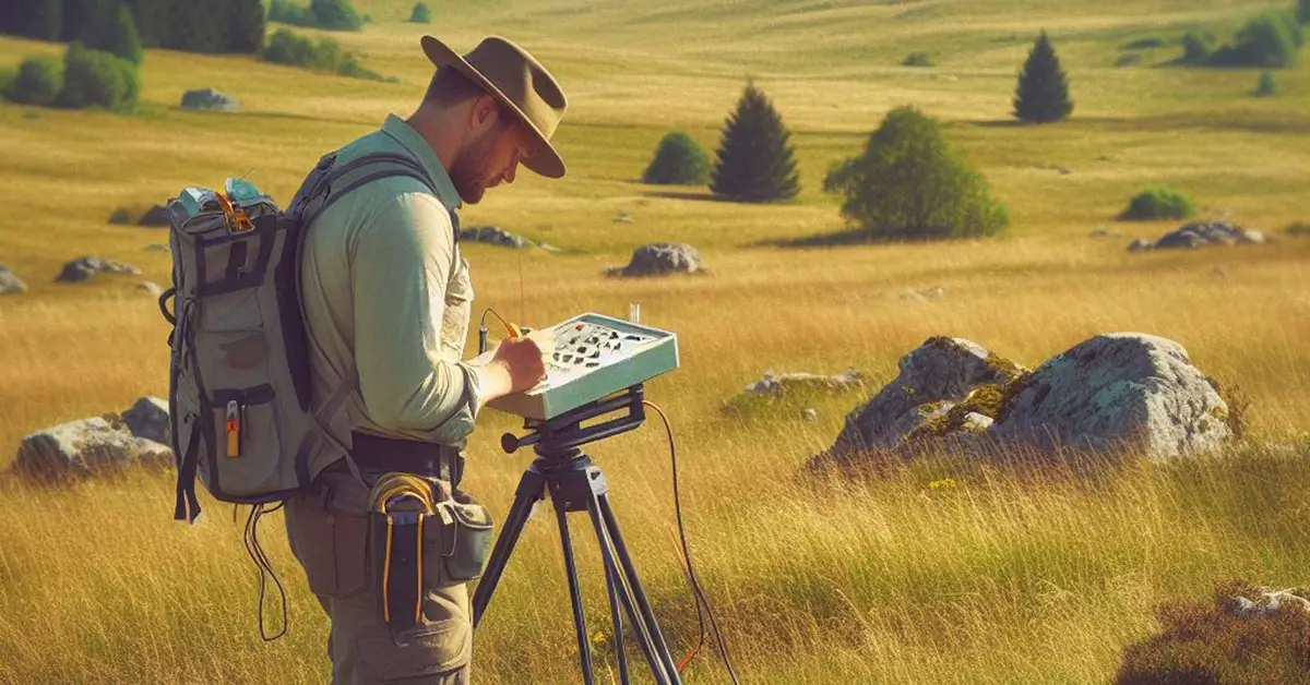
Methods and Techniques in Geophysical Survey in Archaeology
Geophysical survey means the systematic examination of the earth’s physical properties using non-destructive methods to determine archaeological features and sites on both the surface and subsurface.
There are several techniques for ground surveys in archaeological exploration. Generally, techniques are what complete tasks within a method. A method is a process of how something is done. Here, in ground survey in archaeological exploration, the method of surface survey does not contain any specific technique. It only consists of basic techniques of visible inspection, either randomly or systematically. However, the method of geophysical survey contains several techniques, and all of those techniques fall into two categories, as follows:
- Intrusive geophysical survey techniques
- Borehole
- Electronic Resistivity Tomography – ERT
- Non-intrusive geophysical survey techniques
- Metal detecting
- Magnetometry
- Ground Penetrating Radar – GPR
- Light Detection and Ranging – LiDAR
- Geographical Information System – GIS
We can look into each of these techniques and understand their application in geophysical surveys in archaeology.
1. Borehole
The borehole technique involves drilling the ground to take core soil samples across a site. In this technique, the earth is drilled with a hollow drilling bit or with an auger to take the soil sample. Then archaeologists can study the soil layers throughout the site for any archaeological record. This method allows archaeologists to see how a site is formed and which areas are suitable for excavations. However, since this technique causes disturbance to the ground, it falls under intrusive methods.
2. Electrical Resistivity Tomography – ERT
Electrical Resistivity Tomography is a technique that measures the electrical resistivity across the field to determine buried physical features.
In this method, we insert multiple probes into the ground at regular distances. Then DC current is sent through them, and we measure the resistivity of the ground between each probe. Then, using computer software, that data is processed into diagrams, graphs, and maps. Since this technique requires multiple probes to be forced into the ground, it falls under intrusive methods. Yet, this is not destructive or invasive.
This method provides a 2D section or 3D model accompanied by a map of the site. So, archaeologists can examine the patterns of resistivity throughout the site to determine any subsurface features. The easiest features to detect using this method are fixed features such as roads, walls, and ditches.
This method is only applicable in favourable conditions. When the moisture of the soil is low or too high, the productivity of this technique falls and provides inaccurate results.
3. Metal Detecting
Metal detection is one of the simplest survey techniques that archaeologists imply in geophysical surveys. Unlike magnetometers, which can only detect iron concentrations, metal detectors can detect other metals too. Some archaeologists consider this technique not up to standard, while others have already used it productively. However, this falls under non-intrusive techniques.
4. Magnetometry
A magnetic survey is a technique that involves measuring the change in the earth’s magnetic field in order to find objects buried underneath. When something with magnetic properties lies underneath the surface, a magnetometer or gradiometer can detect a change in magnetic field. This can detect solid features like iron artefacts, terracotta artefacts, burnt bricks, burnt floors, stones, and minerals.
This method does not require the installation of probes in the ground. Instead, we can carry the instrument along the grid or linear system covering the site.
Also, there are variations among instruments in magnetometry. They differ regarding the speed of their performance and ease of use.
5. Ground Penetrating Radar (GPR)
Ground-penetrating radar is a technique for detecting material types located in the ground using radio signals. This technique uses high-frequency radio waves that travel at specific speeds. Then, when the radio waves hit something on the ground, they bounce back to the instrument. By measuring the strength and speed of received waves, a high-resolution image is rendered. Experts can detect what lies inside the ground by examining the image.
This method can detect buried structures and other artefacts. and also that this technique is applicable to detecting voids and fractures.
6. LiDAR
The light detection and ranging technique is a remote sensing method that uses light to measure variable distances to the earth. The laser light of this technique can penetrate thick vegetation, resulting in coverage of areas where conducting any other surveys is near impossible. Due to the fact that this technique is fast, it has gained popularity in this context. This technique is expensive and requires expertise. But nevertheless, this method is one of the best techniques in archaeological ground survey because it provides pin-point accuracy and efficiency in areas where any other techniques or methods cannot perform. And this is an airborne geophysical survey technique.
7. Geographic Information System (GIS)
GIS, or geographic information systems, are computer-based techniques to store, process, analyse, render, and interpret geographic data. Archaeologists use GIS to input data they collect in surveys. By doing that, they gain the ability to compare sites and detect patterns, changes, and other characteristics of sites. With GIS, the data from surveys falls under one global entity.
So, archaeologists can study the surrounding geographical features and other archaeological sites with accurate distances and positioning. This helps them study the interrelationships with archaeological sites as well as natural resources in the surrounding territory. This technique is more likely to be a combination of aerial photography, LiDAR, and GPS, which provide maps, 3D models, and many more to study.
Archaeologists use These geophysical techniques vary according to the purpose of the survey, nature of the site, study plan, and funding.
Methods and Techniques in Geochemical Survey
Geochemical survey means the method of studying the chemical composition of a site to determine chemical changes in the soil that result from past human activities and to recognise archaeological sites.
Mainly, there are two types of surveys in this method based on the purpose of the survey, as follows:
- reconnaissance geochemical survey
- detailed geochemical survey
A reconnaissance geochemical survey is the type of geochemical survey that is conducted to get a general idea of the distribution and type of archaeological sites within a given area.
A detailed geochemical survey is the type of geochemical survey that is conducted to obtain a complete and comprehensive view of an archaeological site to determine past human activities there.
A geochemical survey is a highly sophisticated method that includes sampling and testing them in a laboratory for their chemical composition. It includes studies of magnetic susceptibility, soil acidity, organic carbon content, and concentrations of metals such as lead, zinc, and copper. To study these, archaeologists use several geochemical sample types, and the list is constantly growing.
- soil sampling
- sediment sampling
- bedrock sampling
- vegetation sampling
1. Soil Sampling in Geochemical Survey in Archaeology
Archaeologists collect soil samples from the base of the ploughed soil at intervals throughout the field. Then the samples are sent to a lab. Scientists in the lab dry the samples and turn them into pellets. Then they analyse them with an EDX-RF machine for their chemical compounds. They measure the traces of different elements such as iron, aluminium, calcium, and phosphorus. Then archaeologists study the changing levels of these elements to understand the nature of activities throughout the site. These changes in chemical elements provide scientific evidence of different human activities. For instance, higher calcium levels may indicate areas of burials or sedimentary stone deposits, and higher phosphate levels can indicate a garbage pit or livestock compound.
2. Sediment and Bedrock Sampling in Geochemical Survey in Archaeology
Sediment sampling and bedrock sampling work the same way as soil sampling. In that case, the bedrock sampling provides the geological earliest chemical composition of the area. Then the sediment sampling provides the chemical composition of the secondary changes that happened in the area due to natural or man-made causes. With this knowledge, archaeologists can detect secondary changes that occurred at the site that may have led to past human activities by comparing the top soil sample results and sediment and bedrock sampling results.
3. Vegetation Sampling in Geochemical Survey in Archaeology
Vegetation sampling in geochemical surveys is also similar to the other sampling types. However, here the sample is vegetation at the site. Plant life, or flora, can provide us with an enormous amount of data about the past. The chemical compositions of the plants can detect the chemical composition of a site. For instance, if land has been used as farmland for years, it loses certain chemical elements. By testing the vegetation grown on such a farm, scientists can determine if the plants show any indications of a lack of certain minerals. If there is any archaeologist who can detect if the site is ancient farm land or not, how long it has been cultivated, which crops have been cultivated, etc.
As explained above, geochemical surveying enables us to scientifically detect archaeological sites with past human activities, even though the sites hold no physical remnants or written records. But, without any of those, archaeologists can detect areas of past human activity, such as farm lands, garbage pits, sesspits, burials, and many more, on a microscopic scale using this method.
Overall, the most unique importance of this method is that it can detect sites with past human activities even if they have no physical remnants. And this method falls under the non-destructive and minimum intrusive methods of ground survey.
Read full article>>Importance of Ground Survey in Archaeology
Summary
Archaeological exploration is the scientific method of exploring the earth to recognise archaeological sites and archaeological features. Ground survey in archaeology means the type of archaeological survey that is conducted on the ground to detect archaeological sites and archaeological features. It has several typologies. Surface survey and subsurface survey are one typology, and fieldwalk, geophysical survey, and geochemical survey are another typology.
Further ground surveys can be divided into two types: on-site surveys and remote sensing surveys. Surface survey requires visual inspection, while geophysical survey includes sophisticated technology such as ground penetrating radar, LiDAR, magnetometry, electrical resistivity, seismicity, gravity, etc.
The microscopic-level geochemical survey includes soil sampling, sediment and bedrock sampling, and vegetation sampling and is capable of providing information about past human activities at sites with zero physical remnants.
Overall, ground survey is an essential part of the study process of archaeology in order to study the past human culture, behaviour, and cognition through material remains.